
GIS Training for Sinkhole Risk Mapping: East Norfolk Students Tackle a Real-World Environmental Challenge
- VanguardGeo Team

- Jun 7
- 3 min read
GIS Training for Students: Supporting a Real-World Sinkhole Risk Mapping Project
At VanguardGeo, we believe the best way to learn Geographic Information Systems (GIS) is through real-world projects that combine technical skills with genuine environmental challenges.
Recently, we had the opportunity to deliver a hands-on GIS Training for Students programme at East Norfolk Sixth Form College as part of an exciting research project:
"Can We Detect Danger Beneath Without Digging?"
The project is funded by The Royal Society and brings together students from Computer Science, Geology and Environmental Science to investigate potential sinkhole risks across the Great Yarmouth area using spatial data and GIS analysis.
Why GIS Matters for Sinkhole Risk Mapping
Sinkholes can develop when underlying geological conditions, groundwater movement and surface processes combine to create underground voids.
Understanding where these risks may occur requires the analysis of multiple environmental datasets, including:
Geological mapping
Groundwater monitoring data
Historic flood records
Soil erosion information
Infrastructure datasets
Environmental constraints
GIS provides the perfect platform to bring these datasets together, allowing students to identify patterns and understand spatial relationships that would otherwise be difficult to detect.
QGIS Training: Building Professional GIS Skills
During the workshops, students were introduced to professional GIS workflows using QGIS, one of the world's most widely used open-source GIS platforms.
Topics covered included:
GIS Data Fundamentals
Students learned the difference between:
Vector data
Raster data
Point, line and polygon layers
Attribute tables
Coordinate systems
Understanding these fundamentals provided the foundation for the practical mapping exercises that followed.
Spatial Analysis and Environmental Mapping
Students worked with real environmental datasets to explore:
Spatial overlays
Environmental constraints mapping
Geological interpretation
Data visualisation techniques
Risk assessment workflows
Rather than working with simplified examples, students were using authentic datasets similar to those used by environmental consultants, planners and GIS professionals.
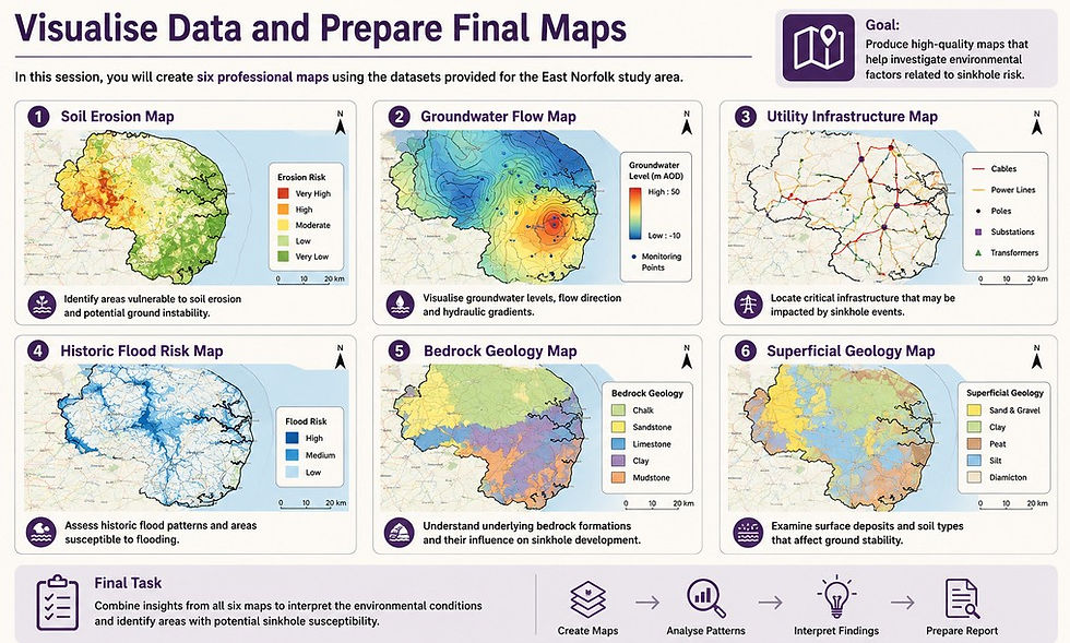
Creating Six Professional GIS Maps
A key objective of the project was to create six final maps that would support future field investigations.
The students produced:
1. Soil Erosion Risk Map
Identifying areas potentially vulnerable to soil loss and ground instability.
2. Groundwater Flow Map
Using interpolation and contour analysis to visualise groundwater levels and potential flow direction.
3. Utility Infrastructure Map
Mapping critical infrastructure that could be affected by future ground movement.
4. Historic Flood Risk Map
Analysing historical flood patterns and areas susceptible to flooding.
5. Bedrock Geology Map
Investigating the geological formations beneath the study area.
6. Superficial Geology Map
Understanding surface deposits and soil conditions that may contribute to sinkhole development.
Students Applying GIS in a Professional Environment
Throughout the workshops, students worked in a dedicated GIS computer suite, using professional software and industry-standard mapping techniques.
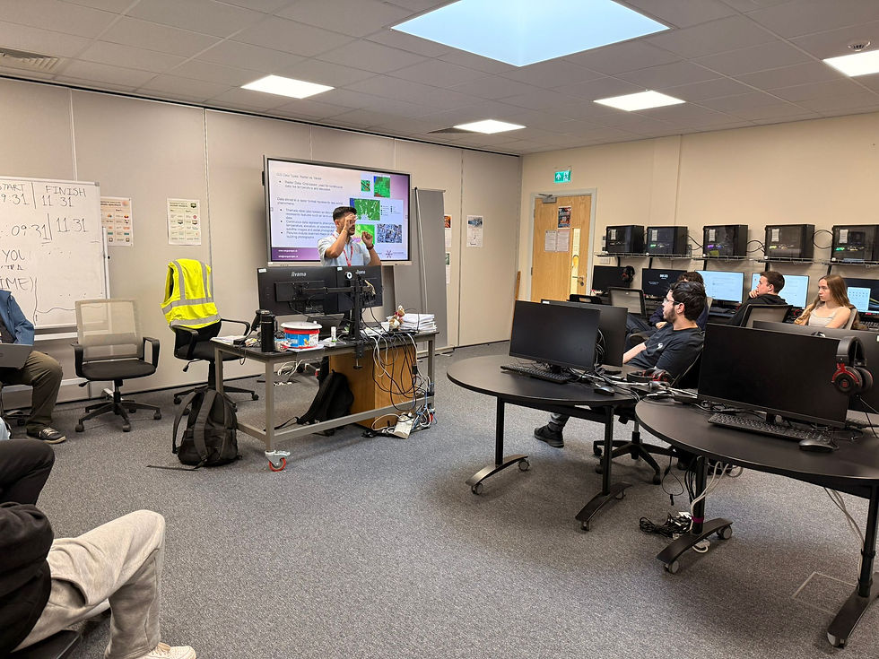
The sessions combined instructor-led demonstrations with hands-on exercises, allowing students to apply new skills immediately.

As the project progressed, students began producing increasingly sophisticated maps and interpreting environmental data independently.

GIS Education and Career Pathways
One of the most rewarding aspects of the project was helping students understand how GIS is used beyond the classroom.
We explored career opportunities across:
Environmental consultancy
Renewable energy
Urban planning
Conservation
Infrastructure
Engineering
Local government
Data analysis
Many students were surprised to discover how widely GIS is used across different industries and how valuable spatial analysis skills have become in today's job market.
From Classroom GIS to Real-World Investigation
The maps created during the workshops will now help support the next phase of the project as Geology and Environmental Science students begin field investigations.
This demonstrates one of the greatest strengths of GIS:
Transforming complex environmental data into practical information that supports real-world decision making.
The project provided students with an opportunity to contribute to meaningful environmental research while developing valuable technical skills that can support future academic and career pathways.
VanguardGeo - GIS Training for Schools and Colleges
At VanguardGeo, we specialise in delivering practical, engaging GIS training programmes for:
Sixth Forms
Colleges
Universities
Environmental organisations
Local authorities
Businesses
Our workshops and training are designed to connect classroom learning with real-world applications, and real dataset from the industry, helping students and professionals develop technical GIS skills while tackling genuine environmental and spatial challenges.
Whether it's environmental analysis, renewable energy, planning, conservation or infrastructure mapping, GIS provides students and professionals with skills that are increasingly in demand across multiple sectors.
Project Acknowledgements
A special thank you to East Norfolk Sixth Form College, the students involved in the project, and The Royal Society for supporting this innovative educational initiative.


Comments