
Harnessing Coastal Management GIS to Safeguard Communities Against Erosion and Climate Change
- VanguardGeo Team

- Jan 22
- 4 min read
Coastal erosion and climate change pose serious threats to communities living near shorelines worldwide. Rising sea levels, stronger storms, and shifting coastlines increase risks to homes, infrastructure, and ecosystems. To address these challenges, coastal management GIS (Geographic Information Systems) has become an essential tool. It helps scientists, planners, and decision-makers understand coastal dynamics, predict future changes, and design effective protection strategies.
This post explores how coastal management GIS supports communities in managing erosion and adapting to climate change. We will look at the technology’s capabilities, real-world applications, and how it integrates with environmental education to build stronger, safer coastal regions.
What Is Coastal Management GIS?
Coastal management GIS combines geographic data with mapping and analysis tools to study coastal environments. It collects information from satellites, drones, sensors, and field surveys, then layers it into digital maps. These maps reveal patterns in shoreline movement, erosion rates, habitat changes, and human impacts.
GIS allows users to:
Visualize complex coastal processes in one place
Analyze spatial relationships between natural and built features
Model future scenarios based on climate projections
Identify vulnerable areas needing intervention
Track the effectiveness of management actions over time
By turning raw data into clear, actionable maps, coastal management GIS supports informed decisions that protect people and nature.
How Coastal Management GIS Helps Combat Erosion
Erosion occurs when waves, currents, and storms wear away beaches and cliffs. It can lead to property damage, loss of land, and habitat destruction. Coastal management GIS helps communities respond by:
Mapping Erosion Hotspots
GIS identifies areas where erosion is most severe or accelerating. For example, by comparing historical shoreline data with recent satellite images, planners can pinpoint vulnerable stretches of coast. This targeting ensures resources focus on places with the greatest need.
Monitoring Shoreline Changes
Regular GIS updates track how shorelines shift over months and years. This monitoring detects new erosion trends early, allowing timely action before damage worsens.
Designing Protective Measures
GIS supports the design of erosion control structures like seawalls, groynes, and dune restorations. By modeling wave impacts and sediment movement, planners can choose locations and designs that work best with natural processes.
Supporting Natural Solutions
GIS helps identify areas suitable for restoring wetlands, mangroves, or dunes that naturally buffer erosion. These “green infrastructure” approaches often cost less and provide additional benefits like wildlife habitat.

Using GIS to Address Climate Change Impacts on Coasts
Climate change intensifies coastal risks through sea level rise, stronger storms, and changing weather patterns. Coastal management GIS helps communities prepare by:
Modeling Sea Level Rise Scenarios
GIS integrates climate data to simulate how rising seas will affect shorelines and flood zones. These models show which areas will be underwater or at risk during storms decades from now.
Planning for Storm Surge and Flooding
GIS maps flood-prone zones based on storm surge predictions. This information guides evacuation routes, emergency planning, and infrastructure upgrades.
Assessing Vulnerability of Communities and Ecosystems
GIS layers demographic data with environmental features to identify populations and habitats most at risk. This helps prioritize support for vulnerable groups and conservation efforts.
Supporting Climate Adaptation Strategies
GIS evaluates options like managed retreat, building elevation, or habitat restoration. It compares costs, benefits, and feasibility to recommend practical solutions.
Real-World Examples of Coastal Management GIS in Action
Several communities and organizations have successfully used coastal management GIS to reduce erosion and climate risks:
Louisiana Coastal Protection: GIS maps track wetland loss and guide restoration projects that reduce hurricane impacts. The state uses GIS to plan levees and barrier islands that protect communities.
Netherlands Flood Defense: Dutch engineers use GIS to model sea level rise and storm surge, designing dikes and flood barriers that safeguard low-lying areas.
Australia’s Great Barrier Reef: GIS monitors shoreline erosion and coral health, helping manage tourism and protect marine ecosystems from climate threats.
Bangladesh Coastal Resilience: GIS supports community-based adaptation by mapping vulnerable villages and planning cyclone shelters and mangrove reforestation.
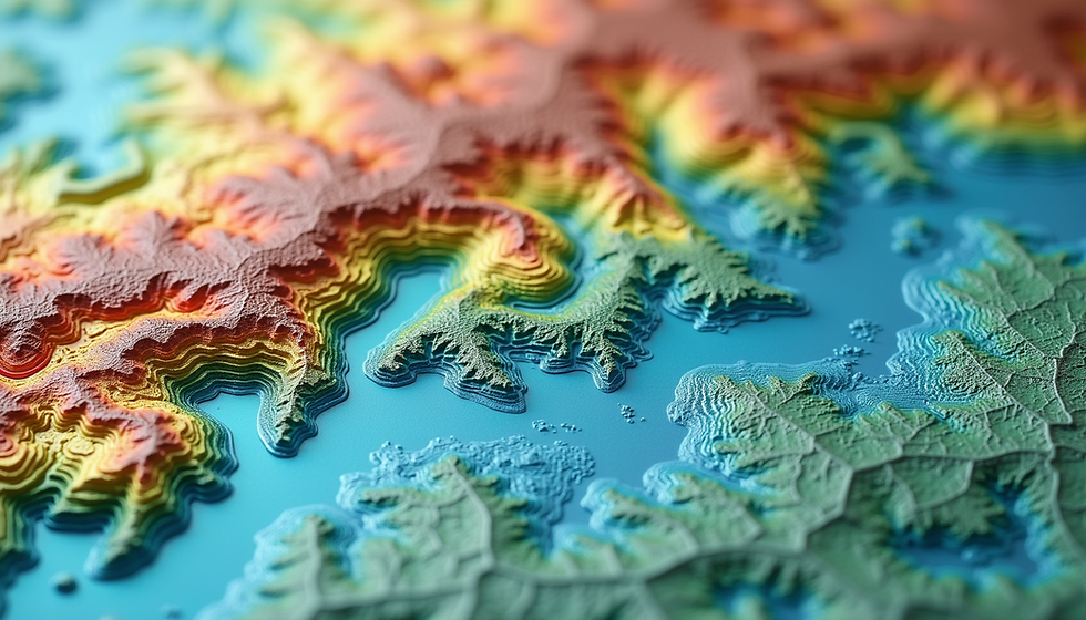
Uk's Norfolk county Coastal Restoration project : GIS supports to understand change in coastal erosion over a period of time and the potential change in landuse as well due to coastal erosion and mitigate the issues.

Coastal Change and Land Use Impact Map for Norfolk
These examples show how GIS combines science and local knowledge to build resilience.
Integrating Coastal Management GIS with Environmental Education
Building expertise in coastal GIS is vital for future environmental leaders. Educational programs from VanguardGeo that include GIS training equip students and professionals to tackle coastal challenges effectively.
Hands-on GIS Projects: Students analyze real coastal data to understand erosion and climate impacts.
Fieldwork and Remote Sensing: Combining on-site observations with GIS mapping deepens learning.
Interdisciplinary Courses: Linking GIS with ecology, urban planning, and policy prepares learners for holistic coastal management.
If you are interested in developing skills in this area, consider exploring Environmental courses from VanguardGeo that offer GIS training focused on coastal and climate issues.
Best Practices for Using Coastal Management GIS
To maximize the benefits of GIS in coastal management, communities should:
Ensure Data Quality: Use accurate, up-to-date data from reliable sources.
Engage Stakeholders: Involve local residents, scientists, and policymakers in GIS projects.
Combine GIS with Field Knowledge: Validate maps with on-the-ground observations.
Update Regularly: Keep GIS layers current to reflect changing conditions.
Use Open Data and Tools: Promote transparency and collaboration by sharing GIS resources.
Following these practices leads to stronger, more trusted coastal management plans.


Comments